
Prescott AZ’s rails-to-trails routes
There’s something about the gradual grade and snaking curves of an old railroad bed that gets my imagination going. Anyone who has childhood memories of hopping from tie to tie on a remote country railroad track can probably relate.
Maybe it’s the fact that in my community in Arizona, there aren’t many intact railroad tracks left – a combination of nostalgia for those faraway train whistles, and regret over the loss of a great resource.
Or maybe it’s the “damn the terrain; we’re going through” attitude that routed local train tracks through thick pine forests and granite mountains. Really, the perseverance required for some of the routes is awe-inspiring.

What I know for sure is that I simply love walking along old rail beds that have been converted into hiking and biking trails.
I’ve long been a fan of the Peavine Trail in Prescott, which follows a route through the stunning Granite Dells, and passes alongside the shores of Watson Lake. Named the “Peavine” for the stretch of old Santa Fe, Prescott & Phoenix railroad that was reportedly as twisty as the vine of a pea plant, the route consists of about six miles of prime hiking-and-biking trail. (See “Ghosts of Trails Past on the Peavine”).

Point of Rocks on Prescott’s Peavine Trail – the old Santa Fe Prescott & Phoenix Railroad
But Prescott’s Peavine is just one of several rails-to-trails routes in the area. Lesser known routes pass through Chino Valley to the north, Prescott Valley to the east, and along a stretch of the Prescott Circle Trail off Iron Springs Road.
While Prescott’s Peavine is the obvious jewel with its jaw-dropping Point of Rocks and numerous granite formations, the other routes offer vistas of chaparral, ponderosa pine forests, and remains of railroad history. I think each of the other rails-to-trails passages in the Prescott area has a charm of its own:
The Peavine north of Highway 89A
Although technically part of Prescott’s Peavine, this one-mile stretch seems a world apart, as it passes through rolling chaparral bordered by bursts of wildflowers and scrubby desert grass.
The weeds flourishing down the middle of the route hint at the relatively low usage of this section of trail, which bumps up against a deteriorating and fenced-off old trestle bridge over Granite Creek. For years, Prescott recreation officials have worked to find a way to complete the section to the north, which would connect up with the Chino Valley rails-to-trails route. With an expanse of private property existing in-between, however, those plans have been largely stalled.
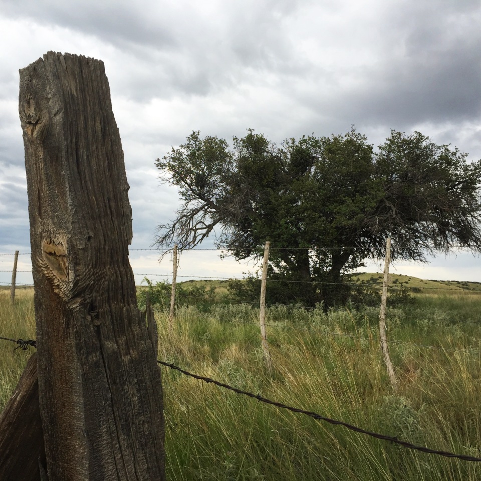
Ranchland bordering the Peavine Trail north of Highway 89A


The old wood trestle bridge over Granite Creek
Still, the short stretch to the north offers a unique appeal. Weathered railroad ties lie alongside the trail, and a rusty barbed-wire fence separates the rail-bed right-of-way from the desolate ranchland to the east.
Owing in part to the dearth of users on the trail, the northern section conjures up the old railroad as perhaps the popular trail to the south cannot do. It’s not much of a stretch to imagine an old locomotive chugging through the high-desert terrain and roaring across the wood bridge at Granite Creek.

The Iron King Trail in Prescott Valley
Branching off the Peavine near the iconic Point of Rocks, the four-mile Iron King Trail is popular with cyclists out for a relatively easy ride, as well as with commuters making the trip by bike between Prescott Valley and Prescott. On a warm spring weekend, the route can feel like a cycling highway at times, with the traffic picking up speed on the gradual descent toward the Town of Prescott Valley.
On its western end, the Iron King shares the granite-strewn terrain of the nearby Peavine, and then transitions into the open ranchland toward the east. The trail follows the route of the Prescott East Railroad, which once served the area’s Iron King Mine – hence, the trail’s name.

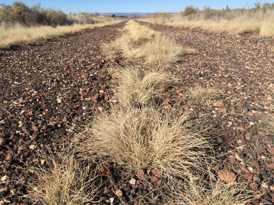
Rocky terrain along the Iron King Trail
The scenery, although somewhat stark, is classic desert highlands – twisted piñon oak, green-tinted granite outcroppings, and long, sweeping views. On a recent evening walk, I spotted a mountain lion in the distance, loping into the underbrush. There were also deer, antelope, and a lone fox.
And lest you forget the history of the place, at regular intervals along the trail are the reminders of the old Prescott East Railroad – rail cars and a variety of railroad equipment. Interspersed along the trail, the rusted relics offer a striking contrast to the gray/greens of the terrain.
One caveat: Recent residential construction in Prescott Valley has brought changes to the access on the eastern end of the Iron King, near Glassford Hill Road. The trail on that end has been rerouted to follow a concrete walkway along Santa Fe Loop. Only time will tell how the Iron King (and the Peavine) fare in the coming years, as residential development continues to spring up nearby.
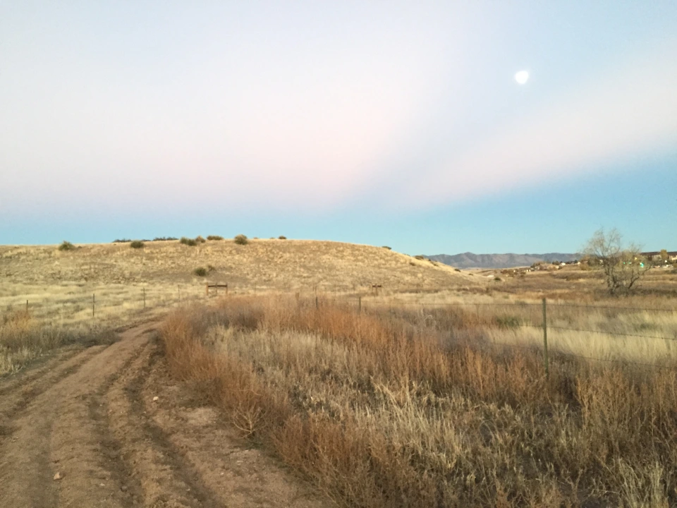
Moonrise over the old section of the Iron King Trail, approaching Prescott Valley

Chino Valley Peavine
I’ll be honest: The Chino Valley section of the Peavine has what you might call a subtle beauty. In the middle of November, when I visited, the trail was bordered by dried weeds, rundown fences, and brown ranchland. Adding to that is the fact that development has sprung up along the route – everything from an RV storage area, to slump-block retaining walls obscuring tract homes.
But look past the slightly industrial façade of the trail, and you’ll see open ranchland speckled with horses, farmsteads, and odd-shaped hills. Look even closer, and you get a glimpse of the snow-capped San Francisco Peaks – miles away in Flagstaff, AZ.
I’m not sure I would return to the Chino Valley Peavine, unless it was part of a longer hike that took in some more interesting terrain. But on this warm fall Saturday, it wasn’t a bad way to spend an afternoon.

Autumn on the Peavine Trail through Chino Valley

Flagstaff’s snow-capped San Francisco Peaks in the distance
Iron Springs branch of the Peavine Trail
Following along the original 1895-to-1962 route of the Peavine, this stretch of trail differs from the area’s other rail-to-trail sections in that it heads straight into a thick forest. Ponderosa pine trees tower on both sides of the trail, offering a beautiful frame for the red-tinted rail bed, and brilliant blue skies.
The route once served as a section of the Peavine between Prescott and Phoenix, but was abandoned after the railroad was rerouted to Skull Valley in the early 1960s.
As a part of the 54-mile Prescott Circle Trail, the route begins off Iron Springs Road west of Prescott, and heads south through the Prescott National Forest. It crosses a number of interesting old tunnels, which are still passable and fairly easy to get to.
I love this section of the Circle Trail, because its broad, flat surface is perfect for a quick power walk. The hike south is easy, because it drops gradually in elevation. Of course, the hike back to the trailhead can get your heart pumping, because of its (deceptively) gradual rise.
The rail bed continues for just over a mile, before the Circle Trail branches off into the forest, and heads past an interesting old ruin of an old fireplace, a crossing with Willow Creek, and some steep mountain climbs.

The Peavine Trail off Prescott’s Iron Springs Road


Even though it’s been decades since the Prescott area has had train service, the conversion to trails of small sections of the old rail route helps to keep the history alive.


Subtle and beautiful – I want to go now. What a great hike to have a long talk & a picnic!
LikeLike
Yes yes yes🎈🎈🎈🎈🎈🎈🎈
LikeLike
I,m a volunteer with Chino Valley.I help maintain the Chino Valley Peavine Trail. (Richard Coleman)
LikeLike
Good work! I love the Peavine. I need to get back to the Chino Valley part soon. Thanks for reading.
LikeLike
Amazing photos and writing. Looking forward to our walk and talk!
LikeLike