 “Over the red lands and the gray lands, twisting up into the mountains, crossing the Divide and down into the bright and terrible desert, and across the desert to the mountains again, and into the rich California valleys.”
The Grapes of Wrath
For me, any mention of Route 66 always conjures up images of John Steinbeck’s epic novel “The Grapes of Wrath” and the fictional Joad family’s arduous journey from Oklahoma to California.
Over the years, I’ve taken in bits and pieces of the historic highway, always marveling at the narrow two-lane road and its status for decades as America’s main east-west route between Chicago and Santa Monica, California.
A recent re-reading of “The Grapes of Wrath” set me to wondering about Arizona’s remaining sections of the original roadway. And, since I live within a few hours of all of the Arizona towns along the route, I decided to spend the coming weekends retracing the Joads’ route through the state.
Starting with Holbrook in the east, my goal is to head west, like the Joads – taking in Winslow, Two Guns, Flagstaff, Williams, Hackberry, Kingman, and Topock – all the way to the Colorado River on the California border. Of course, along the way, I’ll be stopping at some of the cool roadside attractions and epic hikes as well.
Holbrook’s Painted Desert
For a taste of Steinbeck’s Route 66 odyssey, minus all of the Great-Depression-era heartache, the eastern-Arizona community of Holbrook is the perfect place to start.
Drive along the lonely stretch of highway, through the sandy washes and the Painted Desert east of town, and it doesn’t take a huge leap of imagination to picture a parade of rusty jalopies carrying down-on-their-luck Dust Bowl refugees heading to the golden opportunities of California.


For Steinbeck’s Joads, no sooner had they crossed the New Mexico/Arizona border than a “border guard” stopped them. I loved the little exchange that ensued between the guard and Tom Joad. Border guard: “How long you plan to be in Arizona?” Tom: “No longer’n we can get acrost her.” Guard: “O.K. Go ahead, but you better keep movin’.” Tom: “Sure. We aim to.”
With that, Steinbeck wrote, the Joads “crawled up the slopes. Holbrook, Joseph City, Winslow.” Then, “through a gap, they looked own on the Painted Desert.”
And what a sight it is, and probably was.
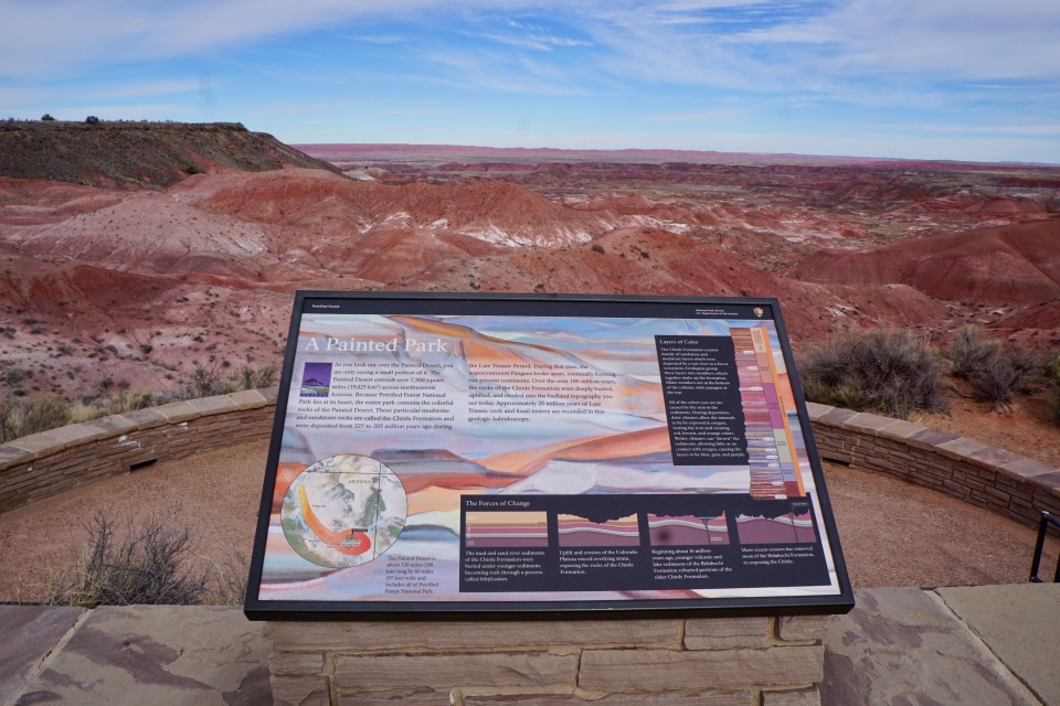
Certainly, Steinbeck’s “bright and terrible desert” is all right there. The cracked and barren buttes of the Painted Desert – stretching far into the distance – must have looked slightly terrible to the flood of migrants.
But, there is also no denying that plenty of brightness is present as well in the rolling red hills and blue-hued layers of rock.

Heading east, I exited Interstate 40 at the Painted Desert (at exit 311, about 50 miles west of the New Mexico border) and then turned southward through the Petrified Forest National Park (entrance fee, $20), following sections of the old Route 66. Soon, I came to a pullout area that explains the old highway connection.
Complete with a rusted old car body, gloomy skies, and dusty tumbleweeds, the area definitely had the old Route 66 feel.


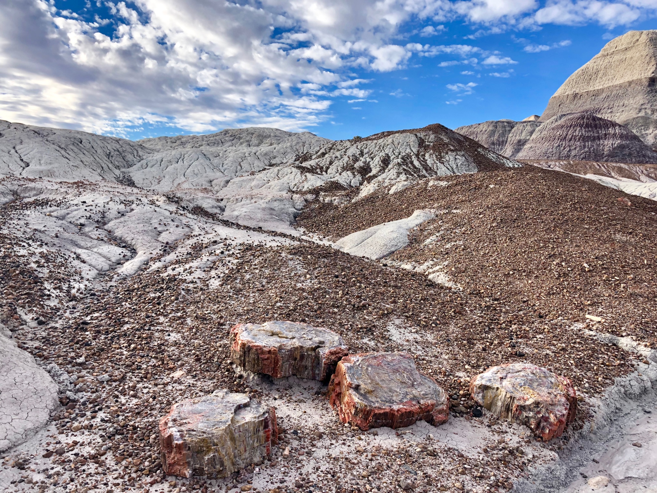
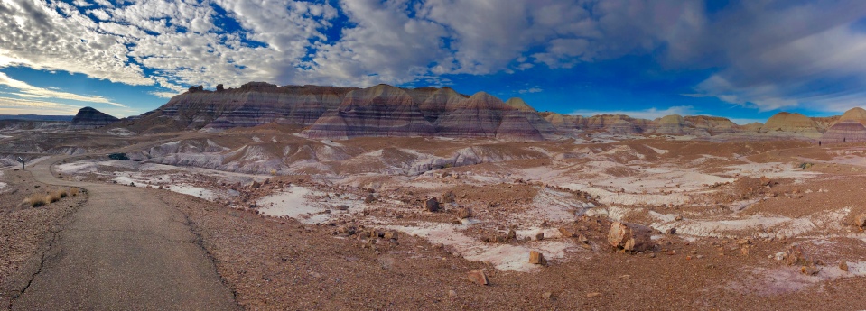
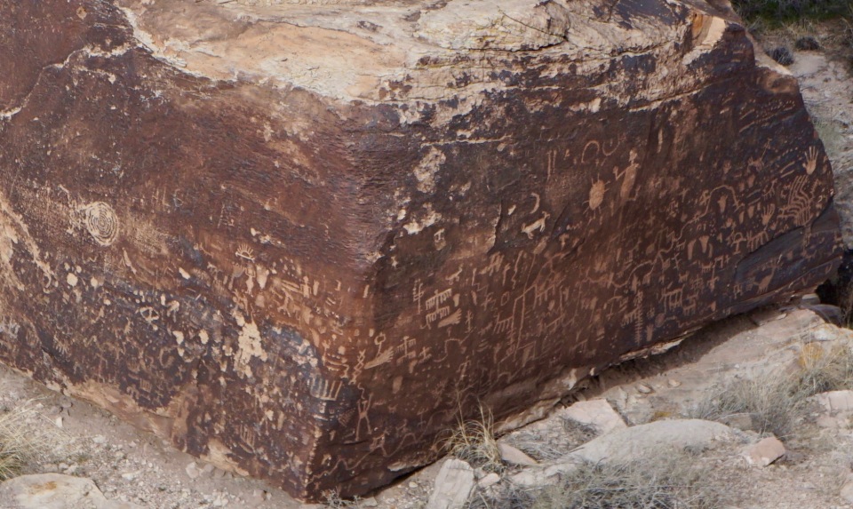
The drive through the park is 28 miles long, and passes by a number of attractions and trailheads. I especially enjoyed Newspaper Rock – a large outcropping with dozens of prehistoric petroglyph rock carvings. The petroglyph area is closed off to hiking, but the carvings are visible through a zoom lens.
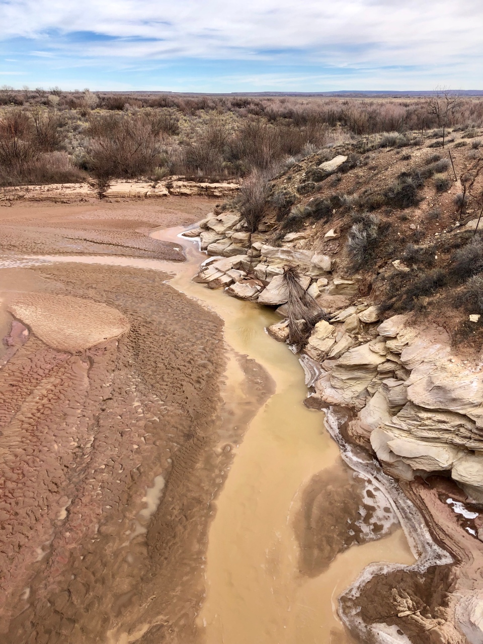
Farther south, the road crosses the Puerco River – a great place for a stop to take in the sprawling riverbed and the nearby historic pueblo.

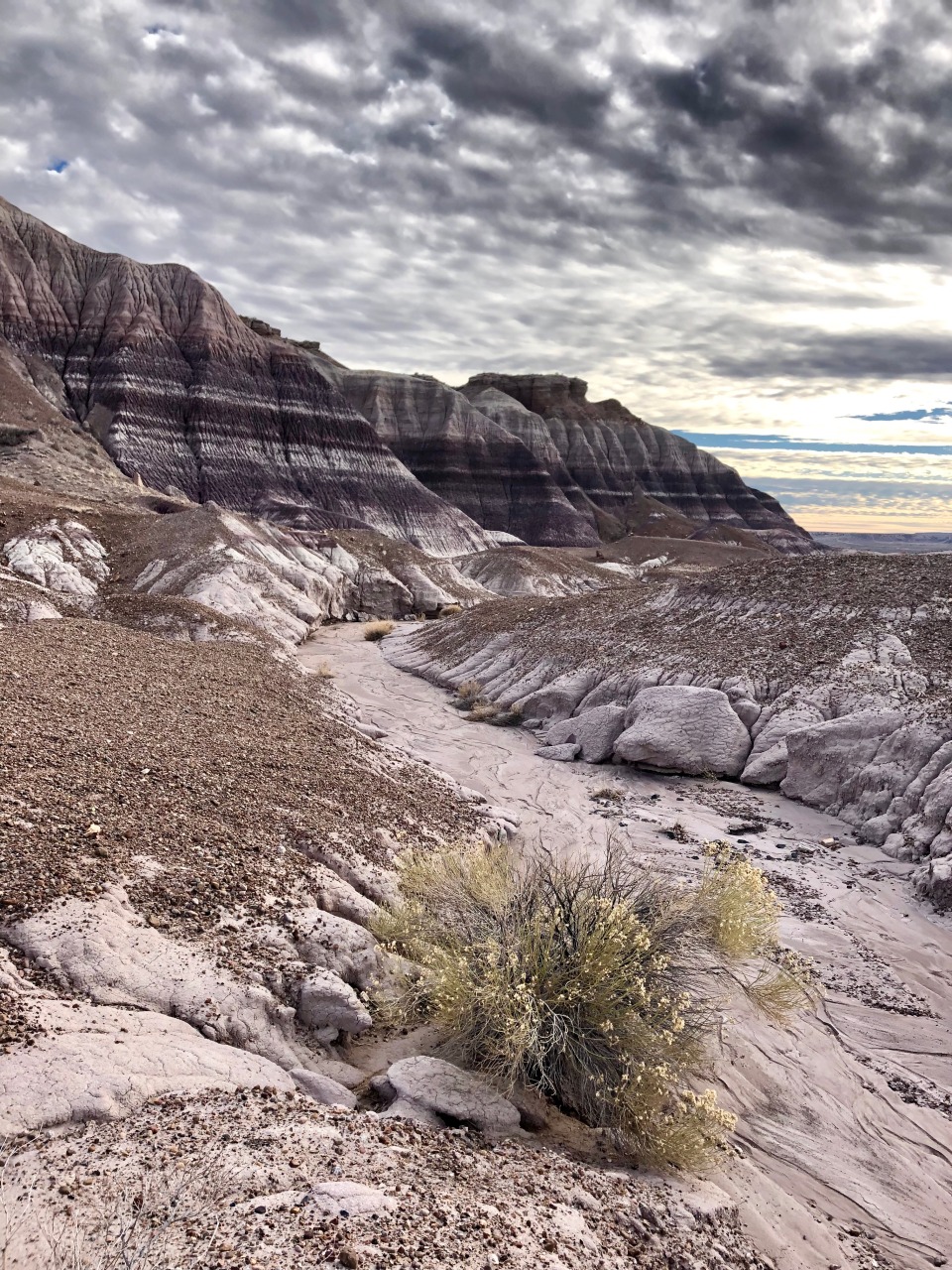
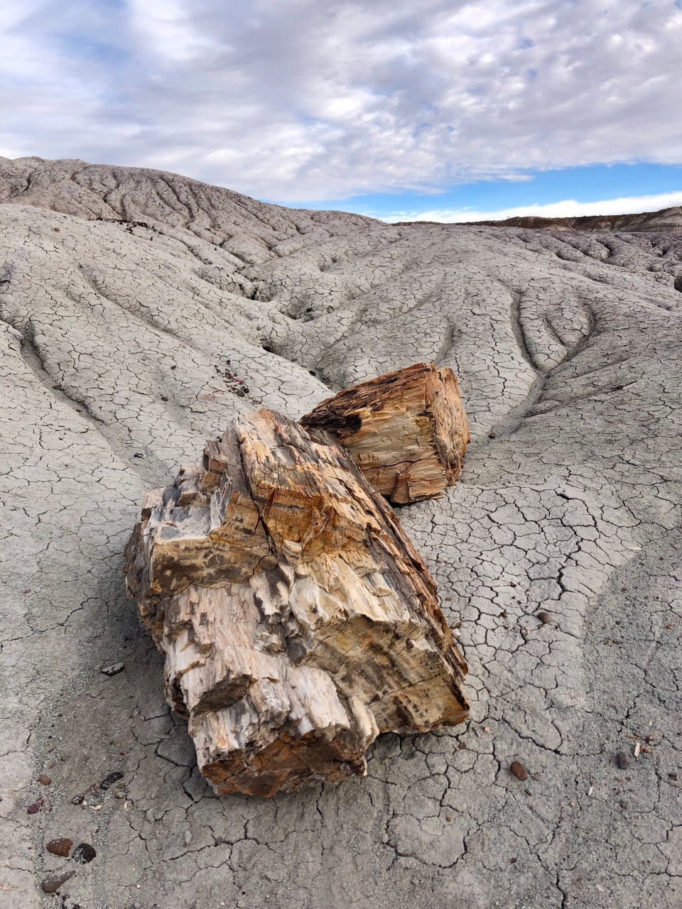
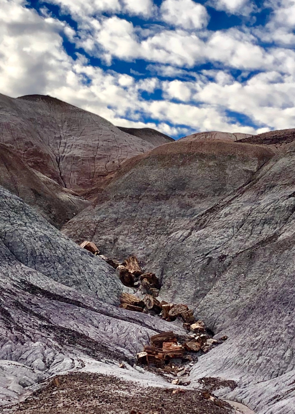
Out of the half-dozen or so hiking possibilities, I chose the Blue Mesa Trail – a slightly remote area about three and a half miles east of the main park road. It was a great choice. On the January Sunday afternoon I visited, I had the trail nearly to myself.
The surreal surroundings and the moody sky make for a truly unique hike!


Holbrook
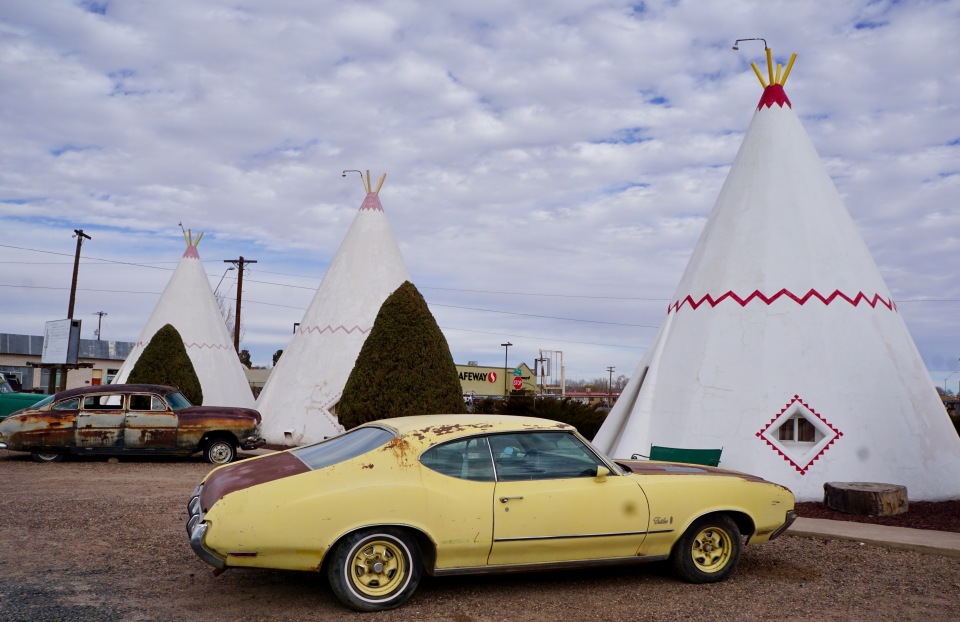
About 20 miles northwest of the southern entrance to the Petrified Forest National Park is Holbrook, a somewhat frozen-in-time town of about 5,000. The community will take you back, with its plentiful petrified-rock displays, its classic Wigwam Motel, and its main drag along the original route of the two-lane highway.

Holbrook embraces its vintage feel, with old signs and quirky shops. A stop at Jim Gray’s Petrified Wood Co. offers a glimpse into the huge variety of petrified wood-themed products available.


Although the Petrified Forest National Park is often overshadowed by Arizona’s other magnificent national parks (Grand Canyon, Monument Valley, and Saguaro), it is definitely worth a visit – especially in the winter, when temperatures are mild and crowds are thin. Overall, I thoroughly enjoyed my introduction to Arizona’s Route 66 communities, and I look forward to heading west.
In the coming weeks, I will be exploring some old favorites, like the “Standing on the Corner” intersection in Winslow, and the vintage service station in Hackberry, as well as some new sights such as Oatman and Topock. Come along as I explore Arizona’s place along one of America’s most legendary roads.

Thanks Cindy. Love reading and seeing your blogs.
LikeLike
Thanks for reading, Kristy. I appreciate it!
LikeLike
Thank you, was talking with a friend about Rt 66 and the Grapes of Wrath and came upon your page! Thanks!!
LikeLike